As I have been going through the Original Texts of Indian Epics, especially the Ramayana, I have across some facts which I am unable to reconcile with geographical locations.


Hanuman Crosses the Ocean to Lanka.

I have checked most of the places mentioned in the Ramayana and has even posted the route taken by Lord Rama in search of Sita who was abducted by


Ravana to Lanka.


I also checked the places associated with the Ramayana  in Sri Lanka.


I have been able to find Ravana’s city,his palace,the places where Sita was moved from one place to another in captivity,where She took bath.


I have posted articles on these.


I now have a problem in Sundara Kanda of Ramayana.


Valmiki states clearly that Hanuman jumped from Mahenra Parvatha.


( I found an answer  relating to the place from where Hanuman jumped for Lanka, here the answer was Hanuman did not jump but walked over!


This information is incorrect.


Valmiki states in Sundara Kanda,


niilalohitamaaJNjishhThapatravarNaiH sitaasitaiH |
svabhaavavihitaishchitrairdhaatubhiH samalaMkR^itam ||5-1-5
kaamaruupibhiraavishhTamabhiikshNaM saparichchhidaiH |
yakshakinnaragandharvairdevaklpaishcha pannagaiH ||5-1-6
sa tasya girivaryasya tale naagavaraayute |
tishhThan kapivarastatra hrade naaga ivaababhau ||5-1-7

5,6,7. saH= that, kapivaraH= great monkey, babhau= shone, naagaH iva= like an elephant, hrade= in a lake, tishhThan= being located, tasya girivarasya= on that great mountain’s, tale= foot, naagavaraayute= which had best of elephants, tatra= there, samalaMkR^itam= was decorated by, svabhaavavihitaiH= naturally formed, dhaatubhiH= mineral rocks, chitraiH= of varied hues, sitaasitaiH= (like) black and white, niilalohitamaaJNjishhThapatravarNaiH= blue, red, yellow, leaf color (green), abhiikshNam aavishhTam= surrounded to a great extent by, yakshakinnaragandharvaiH= Yakshas- Kinnaras-Gandharvas, kaamaruupibhiH= who could assume desired form, saparichchhadaiH= together with their families, cha deva kalpaiH pannagaiH= and godly serpents.

That great monkey Hanuma shone like an elephant in a lake, standing on the foot of that great mountain by the name of Mahendra, where many elephants of good breed resided, which was beautifully decorated with many naturally formed mineral rocks of varied hue like black, white, red, blue, yellow and green and which was surrounded by godly serpents and Yakshas, Kinnaras, Gandharvas who were capable of assuming desired form, together with their families.(Verse 8,Sundara Kanda, Sarga 1)

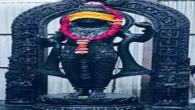
The problem is that Iam unable to find the Mountain in India, save for a refernce to Tirukurungudi  in Tirunelveli district, Tamil Nadu, South India. The taluk of Thirukurungudi isNanguneri and it belongs to Nanguneri Assembly. At the foothills of the Western Ghats and 40 km to the North of Cape Comerin.

This is reported to be the place from Hanuman jumped for Lanka.

Another one is near Rameswaram, where Rama’feet, Ramar Padam, are found with Sugreeva’s Temple.

Both these refernces do not seem to meet with the description of Valmiki.

There is yet another mahendragiri found in Odisha.

There is also the theory that there was an island off the Narmada  River.

This could be the Lankaof Ramayana!

“n an article “The Antiquity of Rama’s Era”, in the journal Prachya Pratibha
(published by Prachya Niketan, a Birla sponsored institution in Bhopal),
Vol. 11-1, 1982[?], the author, R.L. Gupta, a retired engineer and
government secretary, says, that for India’s geography to match that
described in the Ramayana, particularly the existence of the ‘hundred yojana
sea’, the Ramayana era must have been at that time in the geological past
when a lake, large enough to be described by that phrase and abutting the
Vindhyan mountain range where it is described in the Ramayana and is
accepted by geologists as having existed… in the Narmada valley. He
identifies Lanka as an Island in that Narmada lake, now Bagra hill. He also
re-identifies several other places in the the Ramayana by correlating
geographical features and present place names; Chitrakuta, Panchvati (where
Sita was abducted), the Pampawati river, Kishkindha, Mahendra Parvata,
Trikuta Parvata, Rameshwaram, Pampa lake, Kishyamuka, Pravarsan, Mynaka and
Suvela Parvatas, Dhawalgiri and the Setu (bridge) built by Rama… all in
locations in present Madhya Pradesh.

According to the author of the article, Reva Khanda of Skandha Purana speaks
of a big lake or sea in the Narmada valley and that modern fossil finds in
the area substantiate this. He refers to the Madhya Pradesh Chronicle of May
23, 1982 and to an article in the Times of India, June 20, 1982. Geologists
believe in the existence of an ancient lake existing till the middle or late
Pleistocene extending from about the town of Harda, District Hoshangabad in
the west to about the town of Jabalpur M.P. in the east, a distance of over
320 km. At places it was over 300 meters deep and 65 km wide — enough to
appear as a ‘sagar’.

He refers to a book ‘Lanka ki khoj’ which lists many past attempts by
various authors to identifiy the ‘true’ location of Lanka (including,
outside India: Sumatra, the Maldives, Lakshadwip, Liggadwip, 800 miles into
the Indian ocean, Lanka (the present Sri Lanka) and Australia (!), and
within the boundaries of India: Assam, Rekanpalli, between the Godavari and
Krishna rivers, near Maheshwar, near Jabalpur, Amarkantak and near Pendra in
Bilaspur district, M.P. The book’s author (Hiralal Shukla), himself suggests
the Godavari delta as the location of Lanka.

According to Ramayana, Lanka was located on Trikuti Parvata close to
Dhawlagiri surrounded by the hundred yojana sea and in a area where Sal
trees grew (the trees used both by both Hanuman and his followers and Ravana
and company in the Ramaa-Ravana battle). The article describes Bagra hill as
close to and a little west of Pachmarhi Hill, district Hoshangabad, Madhya
Pradesh. Pachmarhi hill is identified in the respected reference book
‘Castes and Tribes of the Central Provinces’ as Dhawlagiri. The article’s
author refers to Survey of India (SOI) topographical map 55 F/14 showing
three hill tops on Bagra Hill at longitude 78° E. It marks the beginning of
a region extending east to Chota Nagpur and south almost to Bhadrachalam on
the Godavari. It also is in a Sal area.

The author says (plausibly), that the phrase “hundred yojana sea” has more
than one interpretation: that it was only a general expression to create the
impression of ‘large size’. In at least one Bhagavatam verse (5.16.23)
‘hundred yojanas’ appears to be used in this way.

It is long ago that I read the complete Ramayan (and would not have
remembered such details in any case) but according to the article, the
Ramayan indicates the sagar as lying along the Vindhya mountain range,
citing that Swanyaprabha, while escorting Hanuman and other Vanaras out of
the tunnel in those mountains, pointed out that they were on Mahendragiri
and that the expanse of water below was the Sagara. Jatayu’s brother Sampati
also indicated the Sagara as the location of the island of Trikuta parvata
with Lanka on it.

The article claims that the geography described in the Ramayana establishes
the antiquity of Rama’s era. The Mynaka Parvata which Hanuman used in his
leap — in geological terms the ‘Vindhyan geosyncline’ (‘uplifted trough’),
came up from the sea. In Rama’s ancestor Bhagtratha’s time, Bhagiratha had
to work hard to bring the Ganga river to the plains. In his father Dilip’s
time, it was confined to the mountains. The Ramayana, also shows that in
Bhagiratha’s ancestor Sagar’s time the river Saryu, which at present flows
southwards, flowed northwards. These changes and events had their causes in
the rise of land masses and the last such land rise of any magnitude in
India is reported by the geologists to have been associated with the
uplifting of the Himalayas in late pleistocene to early recent times. The
drying up of the Saraswati River is another instance… attributed to the
rising up of the Sivalik Himalaya foothills.

Regarding the Setu, causeway, the “bridge”, the topography map of the once
Narmada lake bed shows a formation compatible with its having once been a
setu from near the present town of Hosangabad to about the town of Itarsi
and to the Bagra hill, just where the lake is narrowest. The level of this
formation is fifty metres higher than those of the neighbouring areas.
Furthermore, based on bore hole drillings, the rock in this formation is
different from surrounding rock: It is black basalt, as compared to anything
but black basalt for many kilometres on either side. The floating stone,
presumably pumice, used by Hanuman and the monkeys has the same origin as
black basalt, namely lava flows and is formed by the solidifying froth on
the surface of glassy lava. There is the significant description in Ramayan
that the sea started boiling as soon as Rama but an arrow to his bow. This
could be due to submarine volcanic activity. Furthermore, there is a place
presently known as Bandrabhan which the author points out sounds very much
like “Vänara Bandh”, or the “Bandh (Setu) built by the Vanaras”. The author
says that there is no basalt south of Bombay (Panaji region) except an
isolated flow at Rajamundry, A.P.

According to the Ramayana Hanuman crossed the Sagara by jumping from
Mahendra Parvata north of Lanka. Lord Caitanya visited a Mahendra Parvata
after visiting Madurai and before visiting Setubandha, Dhanus-tirtha,
Ramesvara, the Tamraparni River, Sri Vaikuntham and Kanya-kumari — all in
South India. But Lord Balaram, “after finishing His bathing and ritualistic
ceremonies at Gangasagara, proceeded toward the mountain known as Mahendra
Parvata. After this He turned toward southern India and visited the banks of
the river Godavari” indicating this Mahendra Parvat to be in North India.
The author of the article refers to a hill Mahendra shown on governemt maps
today in the Vindhyan range in the Ken river basin at latitude 23° N, 79° E
and suggests, based on the time Lord Rama took to travel between the places
He visited, that it is the Mahendra parvat of the Ramayana — north of the
Bagra hill and almost at the edge of the Narmada lake.

Ramayana describes the rising of Mynaka parvata from the sagar to assist
Hanuman in his jump over it. The Vindhyas arose from the ocean over 500
million years ago. The author suggests the likelihood that the rise of the
Vindhyan trough coincided with Hanuman’s jump. The uplifted trough has a
break where Hanuman crossed it.


There is anotherview.


The Mahedra Pavatha city is found in, of all places, Cambodia.


And to add to this confusion, the Trikuta Parvatha from where Hanuman is reported to have jumped from Lanka to India is found in Kashmir.


Please read my post Hanuman to Lanka, distance controversy.


A lost city that thrived on a mist-shrouded Cambodian mountain 1,200 years ago has been discovered by archaeologists using airborne laser technology, Sydney Morning Herald reported on Saturday in a world exclusive.

Over two dozen temple sites have been discovered on the site, which is thought to have been built around 802 AD when the Angor Empire was founded.

It is believed to be the lost city of Mahendraparvata, located on a misty mountain called Phnom Kulen deep in the hinterland of Cambodia. It was thought to be built 350 years before the famed Angor Wat. A journalist and photographer from the newspaper accompanied the expedition, led by a French-born archaeologist, through the landmine-strewn jungle in the Siem Reap region where Angkor Wat is located.

Citation.

http://www.indiadivine.org/content/topic/1269560-is-ceylon-the-lanka-mentioned-in-ramayana/

http://www.valmikiramayan.net/sundara/sarga1/sundara_1_frame.htm


http://timesofindia.indiatimes.com/world/rest-of-world/Lost-city-of-Mahendraparvata-discovered-in-Cambodian-jungles/articleshow/20603681.cms

33 responses to “Ramayana Lanka Is Not Sri Lanka?”

  1. Hari Ohm Mr. Ramanan, I have already written your blog which I repeat I have extensivelt researched in Ramayana, visited places related to Valmiki Ramayana. The Lanka of Ravana mentioned in Valmiki Ramayana is neither modern Srilana nolr in India nor Cambodia. it is on the Equator south of modern Sri Lanka. Modern Sri Lanka was physically part of Modern India in ancient times according to Naatyasaastra by Maharshi Bharata which is also proved by modern Geography and science. The Tirikuta Parvata on which Lanka of Ravana existed on the Equator has submerged under the Indian Ocean
    and that place is located near modern Diejo Garcia. The Mahendra Parvata from where Lord Hanuman flew, he very much flew with yogic power and certainly not walk, to Lanka of Ravana is certainly the Mahendragiri, mentioned by you, located near modern Nanguneri taluk in the Border of Thirunelveli District and Kanyakumari District in modern Tamilnadu State in modern South India and the 100 Yojanas mentioned in Valmiki Ramayana as the distance from Mahendra Parvata from where Lord Hanuman flew to Lanka tallies with the distance between Mahendragiri to the now submerged Lanka of Ravana. The Rama Setu was built from Danushkoti, now submerged under Palk Strait during the tsunnami in 1963 C.E. and the Lanka of Ravana now submerged under Indian Ocean, built by Lord Rama with the help of Vanaras. The material used to construct the Ramasetu is celentrades, which have several pores through which when water enters submedges under the Ocean which has what has happened to the Ramasetu.For your information, the Celentrades taken from the Submerged Ramasetu under Palk Strait are sold by People in a in a Religious Mutt in Rameswaram, for Rs.1000/= onwards for various Prices depending on various sizes of Celentrades, which is exploitation of Peoples Religious Beliefs. The Mahendra Parvata where Lord Balarama went is not this Mahendragiri in Tamilnadu State in South India, it is the Mahendra Parvata in Modern Orissa State in modern India and its modern name is Mahendrugiri and not Mahendragiri as incorrectly ,mentioned by you in this blog of yours.
    KSHEMAAYAPUNARAAGAMANAAYACHA
    B.C.VENKATAKRISHNAN.
    website: http://www.vedascience.com

    Liked by 1 person

    1. Hundred Yojanas is approximately 900 miles.Does this tall with the distance from Nanguneri?

      That Mahendra Parvata is in Orissa iquoted by me for addiional information to show that there are more angles to Ramayana.

      Mandodari is from India.

      The town is called Ravana’s inlaw’s City even now.

      I have received an email that Ravana could be from North India!

      I have called for documentation and refernce and am awaiting.on from all sources and leave the decision to the readers.

      Regds.

      Like

  2. Many people remember sri lanka was directly beneath india and not on its south eastern flank as it now appears.There were 3 small islands between india and sri lanka.

    Like

  3. I must not agree with Mr Ramani as he seems diverted wrong by reading some articles. As ramsetu is truth , Lanka was close to where Ram Setu ends. Thanks for owner of vedascience.com to explain. Some articles quoted by Mr Ramani are written by to aim a controversy to sell it as it seems talking about Narmada river as ocean and discribing sauyojan as just a phrase.i suggest Ramani to maintain credibility as his blogs are without going in wrong direction by influence of mad person written article.

    Like

    1. Mr.Pradeep Singh,
      I have not conclude my research and I am sharing what evidence I come across.
      This I have mentioned in most of my posts.
      The question of the distance crossed by Hanuman. 100 Yojanas remain while Rama sethu does not come any way near to it.
      I am trying to get evidence based on the movement of Tectonic plates.I am awaiting informtation to proced further.
      My posts on Ithihasas are written to prove them with the help of Archeology and History and will share information that might not be to the likign of the fervent.till they are proved,I request their patience in the meanwhile.
      I am convinced that the Purans and Ithihasas are facts and I need time to get more facts and in the meanwhile I am sharing whatever I have in the hope that I may get more credible information.
      The article you mentioned does not seem to be credible to me.So I did not write about it but published the comment for readers’ views.
      I m not normally misled.
      Regards

      Liked by 1 person

  4. I am also not agree with that ,, i don’t think it is true.

    Like

  5. the volcano like discussion

    Like

  6. I found a spiritual instruction to go mahendra parvat west side. Any body please help and guide how to reach there

    Like

  7. Dr. Avtaar S. Krishna Avatar
    Dr. Avtaar S. Krishna

    Mr Ramanan !00 yojnas comes to 1,920 km. as one yojna = 6 kosa, 1 kosa = 2 miles and 1 mile = 8/5 km

    Like

    1. True, But how do we account for the Rama Sethu which is only 30Kms? And I have written an article on the speed of Hanuman @ 640kms/hour based on the number of constellations seen by Hanuman.https://ramanan50.wordpress.com/2015/10/20/hanuman-returned-from-lanka-5076-bc-11-am-speed-660km/

      Like

      1. Lets say Hanuman jumped in search of Sita from Mahendra Parvath(odisa), Considering 1 yojana equals 8 miles approximately (http://vaniquotes.org/wiki/One_yojana_is_calculated_to_be_eight_miles), 100 yojanas 800 miles which is the air distance(http://www.distancefromto.net/) from Mahendra Parvath(odisa) to Sri Lanka. After confirming sita was in lanka, Vanaras choose Rameshwaram since it was close to build the sethu(Bridge) to Sri lanka.

        Like

      2. That the Mahendraparvatha ,Odisha is the place from Hanuman jumped from to Lanka is not supported by Valmiki as the descriptions of the places e had visited just before jumping do not match.Please read my post Mahendra Parvatha.Regds.

        Like

  8. Sunderraj.R.Anklikar Avatar
    Sunderraj.R.Anklikar

    I think lanka was at that time near Mauritius. As recent research says that there was a continent in that place. It relates to both valmiki and tulasi ramayan description of exact location. As according to science land moved and collided to form the Himalayas, in the same way the lanka might have moved near to india.

    Like

    1. Nice angle. I Shall research. Thank you for the lead.

      Like

  9. Hi, there
    I have a feeling this will answer your doubts. Do read it.
    BOOK- The Flight Of Hanuman To Lanka Via Sunda Islands
    http://dli.serc.iisc.ernet.in/handle/2015/237725

    Like

    1. Sure. Please my other articles on this issue.Regds.

      Like

  10. Ramanan, my research on the same topic has led me to conclude that Lanka of the Ramayana was in present-day Odisha – I have posted my essay on http://bharatbhumika.blogspot.com/2015/11/geography-of-ramayana.html. You have visited my blog to read my essay on the Puranic chronology of India; I trust you will find my Lanka essay interesting as well.

    Like

    1. Shall visit your site.Thanks and Regards

      Like

  11. Ramesh Ganapathy Avatar
    Ramesh Ganapathy

    I have a completely different theory which i’m pursuing that I’d like to share to ignite the curiosity of like minded persons. I do not state any of this to offend anyone and I humbly apologise in advance if I do.

    I too have always wondered about the true Lanka and the parts of Rama and hanumans journeys that don’t tally for me are these 3.
    1. That the reported distance travelled by Hanuman was so huge that the Vanaras on who awaited Hanumans initial bound into Lanka couldn’t even see a hint of land in the distance.

    2. That it took Rama and Lakshamana almost a year to reach Lanka.

    3. That Hanuman saw strange coloured lights in the sky as he flew to Lanka.

    Rama is also said to have broken up the Rama Sethu after the recovery of Sita.

    I believe Lanka is what is today known as Australia. Till today we can see aurora Australis here sometimes. It definitely fits the bill of a great island due to it’s size and the centre is a desert and bereft of life for generations (perhaps due to a catastrophic war. The aboriginals of Australia have south Indian genetic heritage.

    If you look at the map between India and Australia there are the islands of Indonesia.. entirely formed of “fire from the sea”, volcanic. They look like a broken land mass leading al the way to the northern tip of Australia. When the lord of the oceans comes to Rama to guide him, perhaps it was to guide him to fire his destructive missiles at the points where the earths crust meets (tectonic joints) to create minor volcanic reactions. What could be stones that float other than air filled volcanic rocks.

    I’m at a premature stage of my research but if you have lived in Australia you will know of the asuric nature of this country to this day.

    Like

  12. Ramesh Ganapathy Avatar
    Ramesh Ganapathy

    I believe Lanka is what is today known as Australia. Till today we can see aurora Australis here sometimes. It definitely fits the bill of a great island due to it’s size and the centre is a desert and bereft of life for generations (perhaps due to a catastrophic war. The aboriginals of Australia have south Indian genetic heritage.

    If you look at the map between India and Australia there are the islands of Indonesia.. entirely formed of “fire from the sea”, volcanic. They look like a broken land mas leading al the way to the northern tip of Australia. When the lord of the oceans comes to Rama to guide him, perhaps it was to guide him to fire his destructive missiles at the points where the earths crust meets (tectonic joints) to create minor volcanic reactions. What could be stones that float other than air filled volcanic rocks.

    I’m at a premature stage of my research but if you have lived in Australia you will know of the asuric nature of this country to this day.

    Like

    1. Shall be writing more on this,Please keep in touch.Regards.

      Like

    2. //The aboriginals of Australia have south Indian genetic heritage.//
      They are indeed australoid, and are related with the same ancestral south indian hunterer gatherer. But it’s highly impossible for Australia to be lanka. If anything, the battle of ramayan, actually is battle of King muwatalli of hittites and ramses, and this battle is known as battle of kadesh. It was fought at Syria-Lebanon border, and there are some theory, which suggests that lord ram of hindu is king ramses, while Ravan was some outsider, who was a coloniser. The battle of kadesh is known to be the largest chariot battle, and even ramayan talks about battle being fought on chariots. And none of the army were able to be victorious, they rather went into the peace treaty.
      The later mythologies, created by tulsidas etc are just fables, and the purpose of ramayan in reality was to encourage native people of UP/BIHAR to fight against turk invaders. At that time, northern portion of today’s India got invaded by turkish people.
      Problem is , mythologies cannot be taken as history.

      Liked by 1 person

  13. I have to agree with you mr ramani. Even I had same doubt. Reason for my doubts are:

    -> Ravan is an indo-european by race. He was known as danava, the giant of nordic race.

    -> Vedic south actually means kashmir and parts of pakistan. And it would be true, as for nordic race, kashmir etc would be south.

    -> Another thing, during times of ravan, sanskrit could not have been into existence. Then, from where valmiki wrote his ramayan? Tulsidas had written ramcharit manas in sanskrit, which is proven. And in his ramcharitmanas, he said ravan bad, due to the reason that in those days, there were invasions of mongol, and he wanted natives to fight. He equated the invaders with ravan, nothing more nothing much.

    I have lot of other doubts too, like ravan and parashurama being the disciple of shiva, where as, shiva is not vedic lord.

    But, I feel ravan’s lanka was somewhere else, and not sri lanka, kumari kandam etc.

    Like

    1. Samkirt is very old if anything broken off from Santana Dharma. Samkirt mention wars that existed over 5000 years ago known as Mahabharata battle (also mention in the Bible as Kir) bloodiest war recorded in Indian sub continental family including as in South Asia and Se-Asia.
      This explain why Cambodian/Kambujadas Khmer depicted this war on Nagar Vat aka Suwanipumi . I belief the Mahendra mountain mention in Samkirt is Kambujadas / Cambodia (Son Of Kam) secret mountain…….

      Like

      1. The first war recorded is Ten Kings war, Dasa Raja war. I have written on this. Sanskritam is older by at least 50,000years. Please read my article million year old Tamil quotes Vedas, they quote Tamil. Regards.

        Liked by 1 person

      2. No sir. Tamil predates Sanskrit. Tamil also has it’s form neolithic reconstruction, yes, even subcontinent had neolithic age. However, tamil also has it’s reconstruction, old dialect from Copper Age, Bronze, and Iron age. Sanskrit language does not have any of it’s dialect, and in fact, comes directly transitions from bronze age to iron age. And it’s a well known fact that the language, which became sanskrit, actually was brought by group of people, who used to speak a language, which linguists call as Proto Sanskrit/Rig Vedic Sanskrit etc, but that language belongs to IE families. And these Steppe folks had their empire during Bronze Age.

        Vedas were written during Iron age. This clearly shows that, Vedas were history of some outside civilization, who happen to rule on bharatiya people. Now what’s known is that the last person to invade sindh, afghanistan, persia, of those era was known as Emperor Bharata, who came from West Of Caspian Sea, who was an eurasian nomad, and his kingdom was known as Bharat. He was the last of the nomadic eurasian aryan tribe to invade, and with this, bronze age civilization collapsed, and we enter into the era of Iron Age.

        I can understand, that year of 2017 was the era when modi’s hindutva was at it’s height, so many people were/are not aware. And Indian people of 1947 are freemason educated.

        Like

  14. I have written nearly 200 aritcles about Valmiki Ramayana contents, and particularly Location of Lanka in Orissa, Jharkhand, Chattisgadh, Madhya Pradesh, in the quadrangle of Mirzapur-Bhagalpur-SrikakulamAOB-Chindhwara(MP). Historian Late Sankalia was said to have opined that Lanka is in ChOTA-nAgpur area a triangle near Bhagalpur on South Ganga River. Lanka may be a Ganga River Island port/fort. If you do not think that I am spamming you can read my 195 blogs at ramayanayb.blogspot.com. Or you can google ybrao-a-donkey.

    Like

    1. Interesting approach. Shall visit your blog and write.Am keeping your other comment pending to remind me.Regards.

      Like

    2. Nay, that’s a psuedo hindutva approach my friend to prove somehow, that this battle is uniquely indian. What’s wrong if we get to know the truth, that North Indian people have been worshipping outsiders? Our own nehruji was worshipper of lenin, so that’s how even tulsidas created a fake ram, a foreigner which North Indians worshipped, and shown ravan as a villian. And definitely, this battle did not take place in the so called ayodhaya, an artificial land created by the RSS, but at syria-lebanon. And RSS wants everyone to worship an egyptian occultist god, worshipper of Sun, named as Ram, whose birth is also of obscure origin, strange. Don’t fall in trap of these demonic people, who wants to disturb harmony amongst people, who otherwise, live happily with their own customs and traditions. Hindu, hindutva, hindi people are demonic, satanist, uncultured savages. Don’t ever speak to them. They are not IE people, and don’t even consider tamil nadu as part of India. Why shall states of Andhra, Tamil nadu, kerala, karnatak be even concerned that who was king of mewar and which battle prithvi raj chauhan fought with ghori?
      I guess, people of tamil nadu must not even give importance to ramayan, because, this has nothing in relation with tamil culture, and is a creation of a hindi speaking munda person, named tulsi das, who translated greeks mythlogy as ramayan.

      Like

  15. Have you considered the Tectonic plates at work. Like Ramayan may be at least a lakh year ago and I do remember that Lanka was mentioned to be near the equator. So may be your whole theory is all getting deviated

    Like

    1. I have considered this and have written on this. Please check related posts and articles on Lemuria, Pangea Regards.

      Like

    2. Ramayan took place in Bronze Age, actually. Battle of Kadesh took place in 1274 BC, so if now we compute, it’s 1274 BC + 2022 AD = 1274 + 2022 = 3096. So, ramayan took place 3096 years back, and this should match exactly with the time lines of the Proto Indo-European speakers invasion of central asia, middle east, and northern africa, also some region of Europe at volga, central europe etc.

      Like

Leave a comment

This site uses Akismet to reduce spam. Learn how your comment data is processed.

Trending